


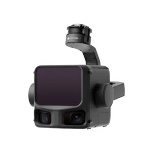
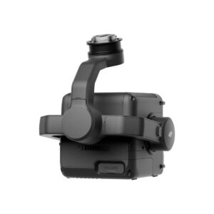
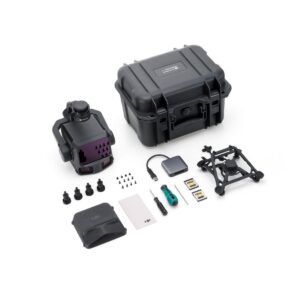
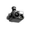
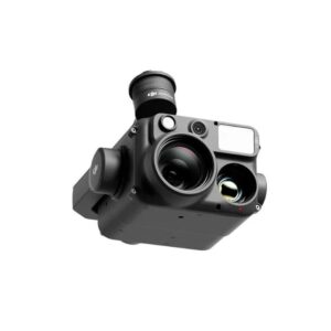
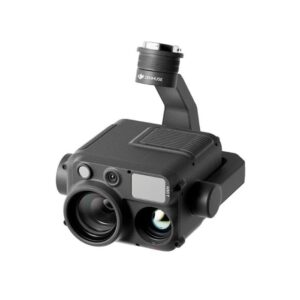
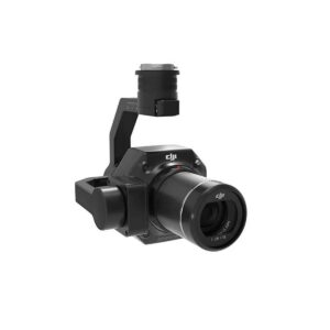
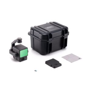
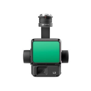
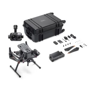
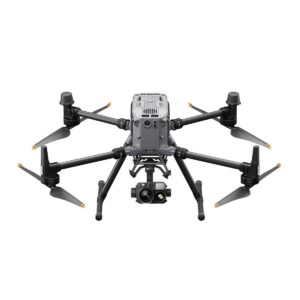
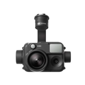
DJI Zenmuse L3 Worry-Free Plus Combo
DJI engineered the Zenmuse L3 Worry-Free Plus Combo to redefine the boundaries of high-accuracy aerial surveying and 3D reconstruction in 2026. First, this next-generation LiDAR payload integrates a high-density laser module with a 1-inch CMOS RGB camera for photorealistic point clouds. Furthermore, the L3 achieves millimeter-level precision, allowing surveyors to capture intricate terrain details even through dense vegetation. As a result, engineering firms and environmental agencies can generate highly accurate digital twins with unprecedented efficiency and speed.
Unrivaled Surveying Protection and Precision
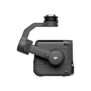
In addition, the L3 features an upgraded IMU and enhanced detection range for high-altitude mapping missions. Specifically, the “Worry-Free Plus” tier provides the highest level of protection through DJI Care Enterprise, offering unlimited free replacements for accidental damage within the coverage period. Moreover, the payload supports real-time point cloud coloring and cloud-based data processing via DJI Terra. Ultimately, the system’s IP54 rating ensures it remains operational in unpredictable coastal or mountain weather. Therefore, the Zenmuse L3 Worry-Free Plus Combo stands as the definitive investment for professionals who require zero downtime and elite mapping accuracy.
KEY FEATURES & HIGHLIGHTS
Next-Generation LiDAR Performance
-
ULTRA-HIGH POINT CLOUD DENSITY: The L3 captures millions of points per second to create a complete 3D model of the environment. Accordingly, you can map complex power line corridors or bridge structures with extreme geometric fidelity.
-
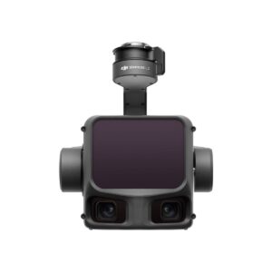
1-INCH CMOS RGB SENSOR: The integrated camera provides high-resolution color data for every laser point. Hence, your final 3D models display realistic textures and colors, making them ideal for urban planning and architectural presentations.
-
SUPERIOR FOLIAGE PENETRATION: The laser system utilizes multiple returns to reach the ground through thick forest canopies. Furthermore, this allows surveyors to generate accurate Digital Elevation Models (DEMs) in areas where photogrammetry typically fails.
Advanced Mapping Workflow and Accuracy
-
INTEGRATED HIGH-PRECISION IMU: The L3 uses a factory-calibrated inertial measurement unit to maintain absolute accuracy throughout the flight. Consequently, you spend less time on manual data corrections and more time analyzing your results.
-
MILLIMETER-LEVEL ACCURACY: DJI optimized the laser pulse frequency to achieve incredible vertical and horizontal precision. Meanwhile, this ensures that your volumetric calculations for mining or construction sites remain accurate to the last centimeter.
-
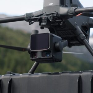
REAL-TIME POINT CLOUD LIVEVIEW: Pilots can monitor the point cloud generation in real-time on the DJI RC Plus controller. As a result, you can verify coverage while still in the air, eliminating the need for costly re-flights due to missing data.
Worry-Free Plus Coverage and Durability
-
UNLIMITED REPLACEMENT GUARANTEE: The Plus plan offers a “no-limit” replacement service for a full year of coverage. Specifically, this protects your equipment against water damage, crashes, and technical failures without the per-incident fees found in basic plans.
-
IP54 WEATHER RESISTANCE: The robust housing prevents dust and water from compromising the sensitive laser optics. Therefore, you can deploy the Zenmuse L3 Worry-Free Plus Combo in challenging climates where moisture and wind are constant factors.
-
SEAMLESS DJI TERRA INTEGRATION: The payload works natively with DJI’s mapping software for one-click reconstruction. Thus, you can transform raw LiDAR data into actionable 3D insights faster than any other enterprise solution.
Be the first to review “DJI Zenmuse L3 Worry-Free Plus Combo”
Related products
ENTERPRISE DRONE PAYLOAD
ENTERPRISE DRONE PAYLOAD
ENTERPRISE DRONE PAYLOAD
ENTERPRISE DRONE PAYLOAD
ENTERPRISE DRONE PAYLOAD

ENTERPRISE DRONE PAYLOAD
Reviews
There are no reviews yet.