


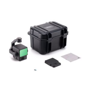
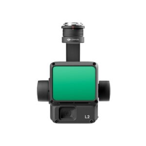
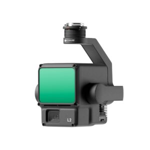
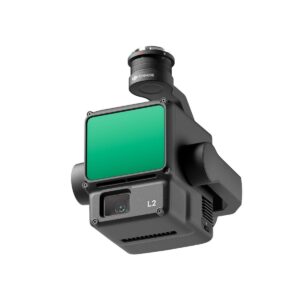
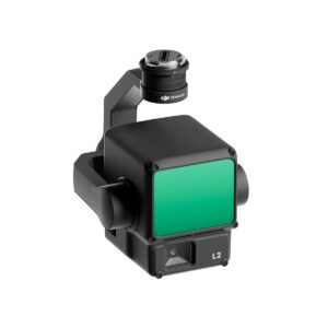
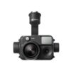
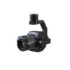
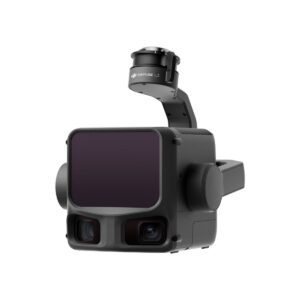
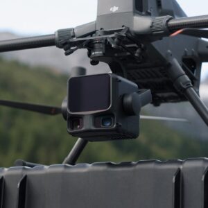
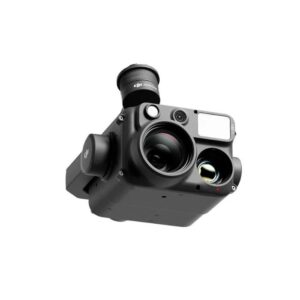
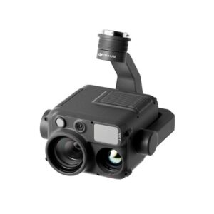
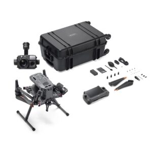
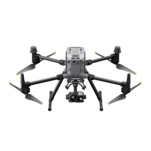
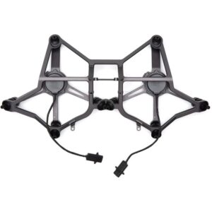
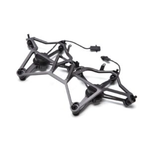
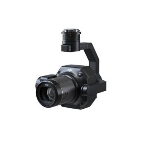
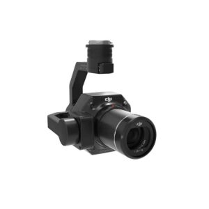
DJI Zenmuse L2 Worry-Free Basic Combo
DJI engineered the Zenmuse L2 Worry-Free Combo to redefine the efficiency of aerial LiDAR and high-precision 3D data acquisition. First, this integrated payload combines a high-accuracy LiDAR module, a self-developed high-precision IMU, and a 4/45-inch CMOS mapping camera. Furthermore, the L2 features a significantly improved detection range of up to 450 meters. As a result, surveying professionals can capture complex topographic data and dense vegetation structures with greater safety and speed than ever before.
In addition, the “Worry-Free Basic” package provides critical protection through DJI Care Enterprise. Specifically, the combo offers one year of coverage and includes up to two affordable replacements for accidental damage, such as crashes or signal interference. Moreover, the system supports up to five returns, allowing the laser to penetrate thick canopies to reach the ground surface. Ultimately, the L2 generates point clouds in real-time with centimeter-level precision. Therefore, the Zenmuse L2 Worry-Free Combo stands as the premier choice for forestry, electricity inspection, and land surveying.
Key Features & Highlights
-
Precision Frame-Based LiDAR: The L2 utilizes a frame-based design with a 100% effective point cloud rate. Accordingly, you achieve a more uniform point cloud distribution and higher vertical accuracy compared to traditional multi-line scanners.
-
Superior Range and Sensitivity: The sensor detects objects at 250m with only 10% reflectivity and up to 450m at 50% reflectivity. Hence, you can fly at higher altitudes to cover more ground while maintaining an impressive 240,000 points per second.
-
High-Precision IMU System: DJI developed this IMU specifically for the L2 to reach centimeter-level accuracy without a warm-up period. Furthermore, it integrates with the drone’s RTK system to provide highly stable heading and attitude data in real-time.
-
Integrated 20MP Mapping Camera: The payload includes a 4/3 CMOS sensor with a mechanical shutter for photogrammetric mapping. Consequently, you can colorize your LiDAR point clouds with true-to-life RGB data during the same flight mission.
-
Five Multi-Return Capability: The laser pulse can penetrate dense foliage and reach the terrain below through five distinct returns. Meanwhile, this provides surveyors with accurate Digital Elevation Models (DEM) even in heavily forested environments.
-
Real-Time Point Cloud LiveView: Pilots can monitor the 3D model acquisition directly on the DJI RC Plus controller. As a result, you can verify data coverage in the field to ensure no gaps exist before returning to the office for processing.
-
One-Click Post-Processing in DJI Terra: The L2 works seamlessly with DJI Terra to generate standardized 3D models and reports. Specifically, the software handles point cloud classification and ground point extraction with minimal manual intervention.
-
Worry-Free Basic Protection: This combo includes the DJI Care Enterprise Basic service plan for total operational security. Therefore, you can deploy your Zenmuse L2 Worry-Free Combo in challenging environments knowing that DJI covers accidental damage.
Be the first to review “DJI Zenmuse L2 Worry-Free Basic Combo”
Related products
ENTERPRISE DRONE PAYLOAD

ENTERPRISE DRONE PAYLOAD
ENTERPRISE DRONE PAYLOAD
ENTERPRISE DRONE PAYLOAD
ENTERPRISE DRONE PAYLOAD
ENTERPRISE DRONE PAYLOAD
Reviews
There are no reviews yet.