


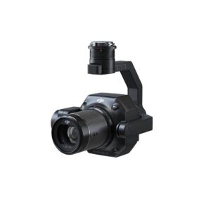
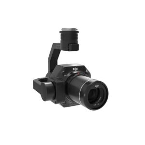
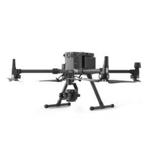

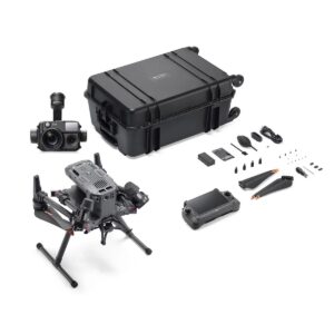
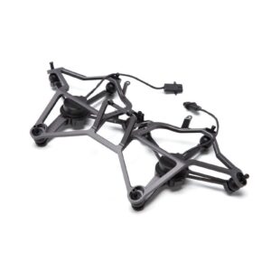
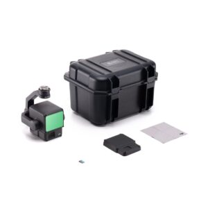
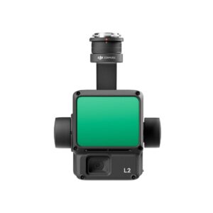
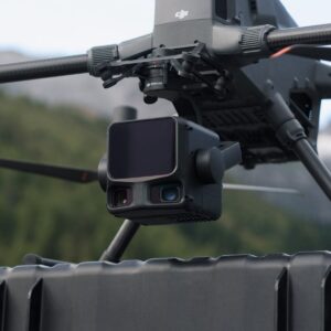
DJI Zenmuse P1 Worry-Free Basic Combo
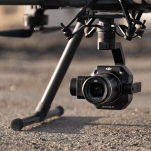
DJI engineered the Zenmuse P1 Worry-Free Combo to set a new benchmark for aerial photogrammetry and high-precision mapping. First, this enterprise-grade payload integrates a massive 45MP full-frame sensor on a stabilized 3-axis gimbal. Furthermore, it utilizes a global mechanical shutter to eliminate rolling shutter distortion, even when flying at high speeds. As a result, surveying professionals can capture centimeter-accurate data over vast areas with significantly fewer flight missions than previous generations.
In addition, the “Worry-Free Basic” designation provides comprehensive protection through DJI Care Enterprise. Specifically, the combo includes one year of coverage and offers up to two affordable replacements for accidental damage during the protection period. Moreover, the system supports the specialized Smart Oblique Capture feature, which automatically rotates the gimbal to capture 3D data with maximum efficiency. Ultimately, the P1 delivers survey-grade results without the need for ground control points (GCPs). Therefore, the Zenmuse P1 Worry-Free Combo stands as the ultimate turnkey solution for the Matrice 350 RTK and M300 RTK.
Key Features & Highlights
-
45MP Full-Frame Power: The high-resolution sensor captures incredible detail with a 4.4μm pixel size. Accordingly, you achieve superior signal-to-noise ratios and extreme clarity that allows for a Ground Sampling Distance (GSD) of 3 cm at high altitudes.
-
Global Mechanical Shutter: The central leaf shutter reaches speeds of 1/2000s to prevent image warping. Hence, you maintain geometric integrity in every frame, ensuring that your 2D orthomosaics and 3D models remain tack-sharp.
-
Smart Oblique Capture: The gimbal automatically maneuvers to take photos at multiple angles during a single flight path. Furthermore, this process filters out unnecessary images at the edge of the survey area, increasing post-processing efficiency by up to 50%.
-
Centimeter-Level Accuracy: By integrating TimeSync 2.0, the camera synchronizes with the flight controller and RTK module at the microsecond level. Consequently, you achieve an absolute accuracy of 3 cm horizontally and 5 cm vertically without laying a single GCP.
-
Exceptional Operational Efficiency: The P1 can cover up to 3 km² in a single flight with a photo interval of just 0.7 seconds. Meanwhile, this speed allows you to map up to 7.5 km² in a single workday while maintaining professional-grade precision.
-
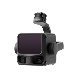
Interchangeable DJI DL Lenses: The combo natively supports 24mm, 35mm, and 50mm fixed-focus lenses. As a result, you can adapt your field of view to match the specific requirements of topographic mapping, corridor surveys, or detailed 3D modeling.
-
Fieldwork Quality Reports: The system generates data quality reports immediately after the flight. Specifically, you can verify RTK status and the number of acquired images before leaving the site to ensure your mission was a total success.
-
Worry-Free Basic Protection: DJI includes the Enterprise Basic service plan for total peace of mind. Therefore, your investment remains protected against crashes, water damage, or signal interference through a streamlined replacement process.
Be the first to review “DJI Zenmuse P1 Worry-Free Basic Combo”
Related products
ENTERPRISE DRONE PAYLOAD
ENTERPRISE DRONE PAYLOAD
ENTERPRISE DRONE PAYLOAD
ENTERPRISE DRONE PAYLOAD

ENTERPRISE DRONE PAYLOAD
ENTERPRISE DRONE PAYLOAD
Reviews
There are no reviews yet.